 Tombstone Territorial Park was the most northerly destination of my Yukon Journey. At 65 degrees North, it was just below the arctic circle, which is the start of the land of the midnight sun. I was there during the longest day of the year, but the heavy clouds and rain made the night much longer and duskier than one would expect.
My Yukon Journey was the first trip I have done in forty years where I had no slide show presentations planned. It was just supposed to be a vacation. But a contact in the Yukon, Julie, who was known by three of my acquaintances – all naturalists – passed me on to the Friends of the Dempster. Turned out they were having their botany days weekend 22 – 25th June, and they asked me to be a speaker.
The Tombstone Territorial Park is between kms 55 and 85 on the famed Dempster Highway, the road that goes the most northerly in Canada, ending currently at Inuvik, but which will shortly reach Tuktoyuktuk on the Arctic Ocean.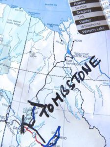 The Dempster (this is a different link) has long been famed as a gruelling drive. It is not paved, and is subject to wild weather and a lack of services. Many people drive it just for the sake of saying that they have done it. Maybe I will too, one day, but it was not the purpose of my trip. I started along it after visiting the orchids at Dawson City. First, there was a forest fire warning.
 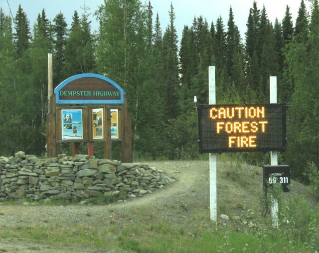 This was the fire that had made the Keno Hill all smokey – later I heard motorists comment that the highway had been closed for a while, but when they drove through the smoke was so thick they could not see a thing.
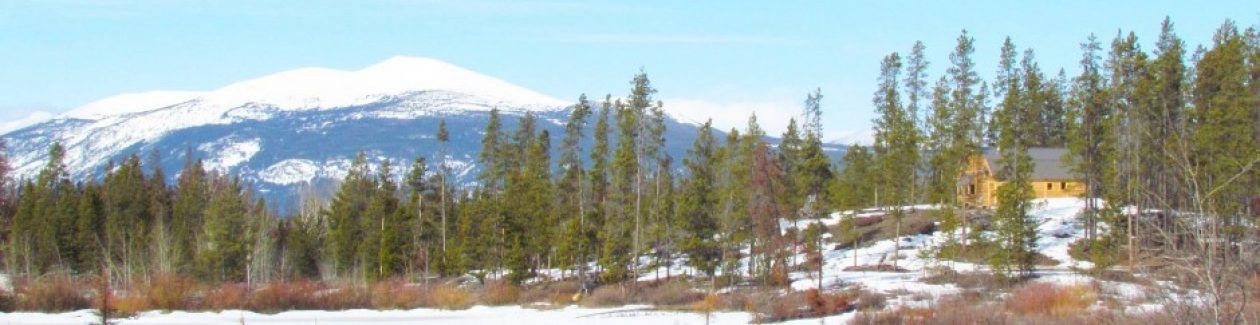
Now I have had a lot of experience of forest fires. What, I wondered, was there that far north that would burn? But as you can see behind the signs, it was amazing how tall the trees were at these high latitudes. They would never grow this far noprth in the centre or east of Canada – only in the west.
An older sign (complete with the obligatory bullet holes.)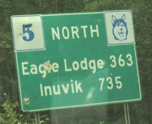 More signs advertised major bridge repairs, and finally, seemingly as an afterthought, there was this.
 In other words, if you are going up the Dempster, carry extra gas.
My contact, Julie, lived at km 9.2 (The distance is posted every 2km.) She inhabited a rickety old cabin buried in trees.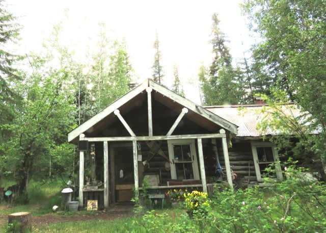 Julie herself had no less character than her house – a trait I was to find with all the people I met over the weekend. A recent hobby of hers was archery and she did a few practice shots while I camped in her yard and caught up on laundry.
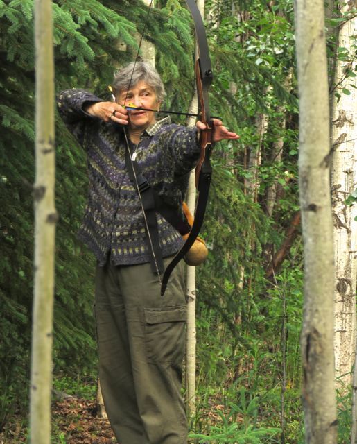 Even up north, people stayed up late and did not rise until the clock indicated it was time for business. I, however, crashed and rose early as always; my rewards were a couple of quieter hours on the roads where I usually encountered most of my wildlife sightings. The treat of the following morning was this:
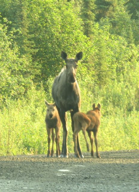 Julie had recommended the Grizzly Creek trail at Km 55 as a way to get to the alpine. Well it was, but first I had to negotiate a tall forest.
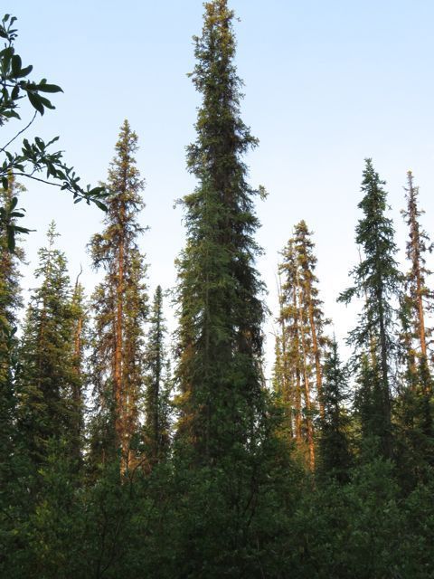 The floor was thick with vegetation, predominately horsetails,
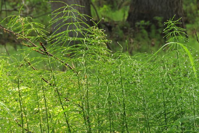 and thickets of bluebells in the open spaces where trees had blown down,
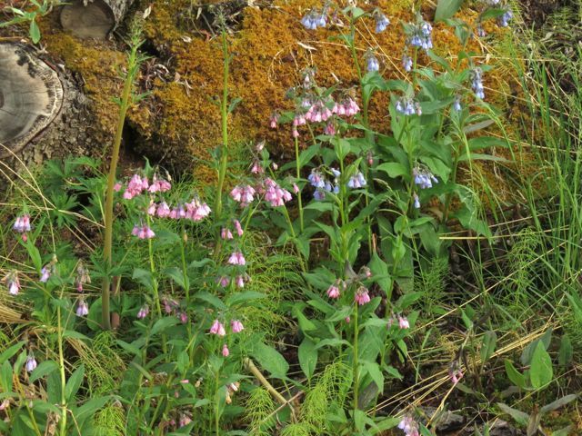 And yet another pea, which I later learned had the delightful name of hairy arctic milk vetch.
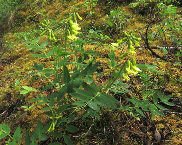 The trail became very steep. Finally, we got out of the trees, but had to climb through a wide zone of rather featureless dwarf birch.
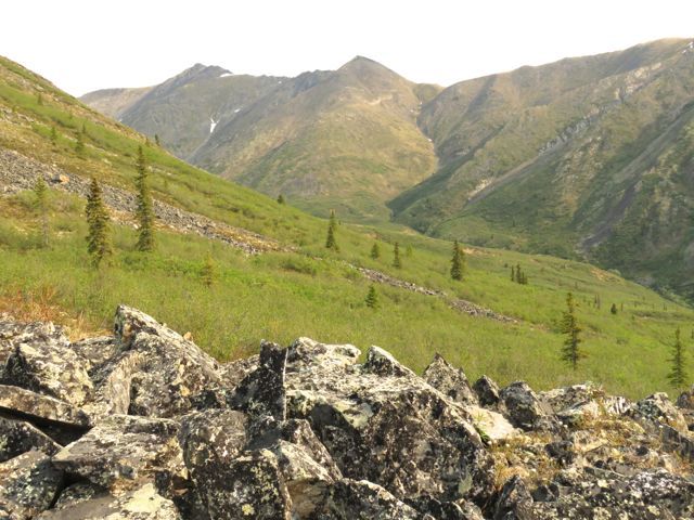 And when I got to the alpine, the few species that were up there had long since fried in the unrelenting drought. It was very hot that day as it had been for a while – none of the rain I had experienced had reached this far north. 500 metres below was the Dempster Highway in its smokey valley.
 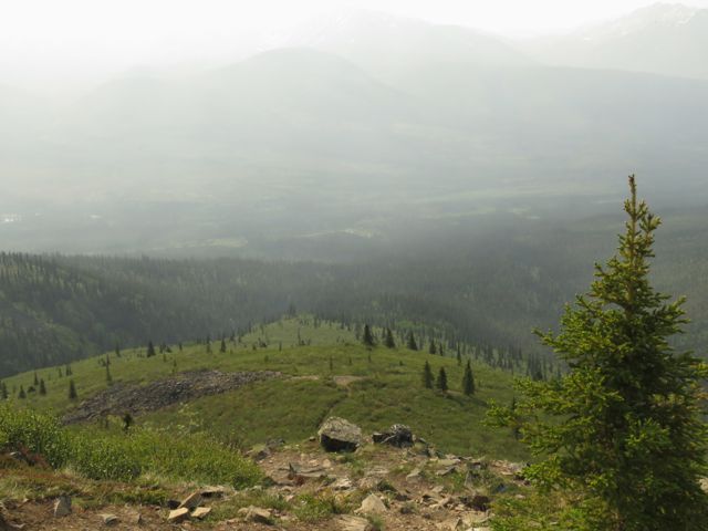 The view the other way encompassed Monolith Peak. Like so many of the mountains at home, these vertical bastions are the hard, remaining cores of old volcanoes.
 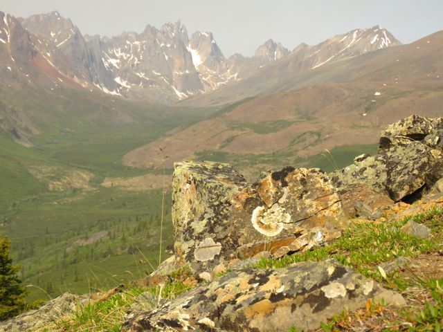 The view was also enjoyed by a townsend solitaire,
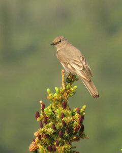 and a complacent-looking hoary marmot.
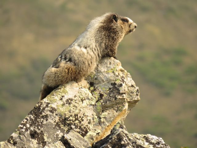 Other hikers soon galloped on by, but I found the heat and steepness gruelling, and by the time I got down to my vehicle, my knees were in a pretty bad shape. After all the other plant successes I had enjoyed, I was quite disappointed and wondered what the area would have to offer me.
A few kms up the road was the park headquarters and I introduced myself and asked where it would be best to find alpine plants. Concensus was Angelcomb Mountain next to the highest part of the Dempster a few kms north. However, it was closed for lambing season. But I figured if I drove to the pass, I would have less dwarf birch to fight through so might see something interesting.
Angelcomb Mountain was easy to find.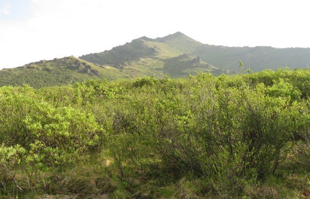 Nest to it was a small hump with a few rocky outcrops. I wove a way between the birch and willows, then found a bit of a trail to the top of the hump. I did not realize that this was actually part of the forbidden mountain until I got to the top of the hump and saw the trail heading for the main peak. However, I saw no sheep, not even any droppings, and once up there it was so fascinating I wasn’t about to come down in a hurry. Plants I had not seen before were:
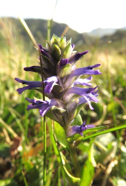
Weasel snout.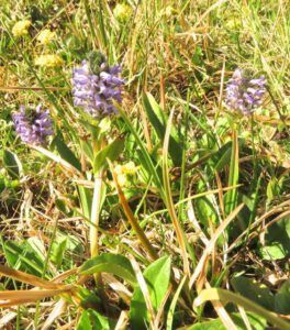
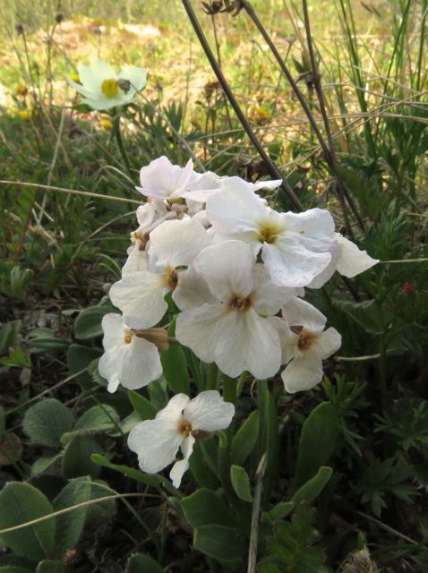
 Parry’s Wallflower (a friend from the central arctic: related to the cabbage.)
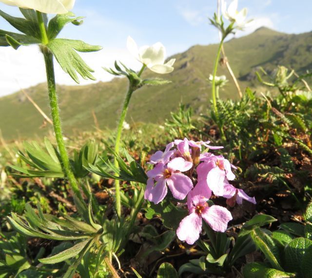
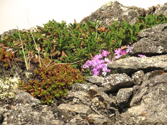
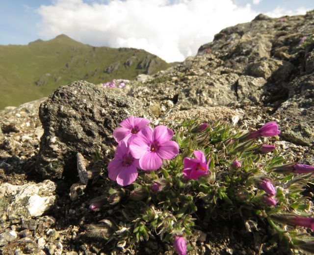
 Siberian phlox (I think).
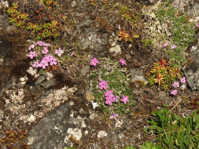
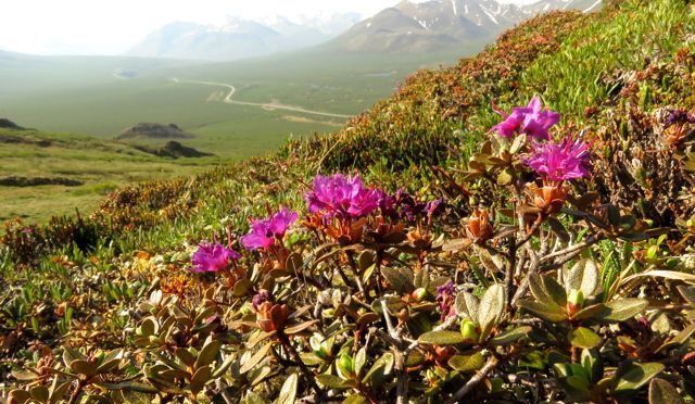
 Despite it’s northerly location, this area was bizarrely avoided by the last ice age and plants exist specific to the region because of this. One was the Ogilvey draba (another cabbage relative – bet you didn’t think of cabbages as being so pretty!)
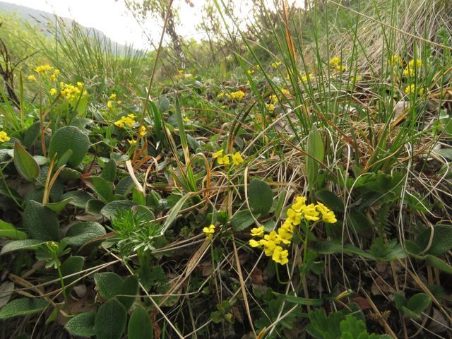 I also found another single plant of the little pink rhododendron first seen on Keno Hill.
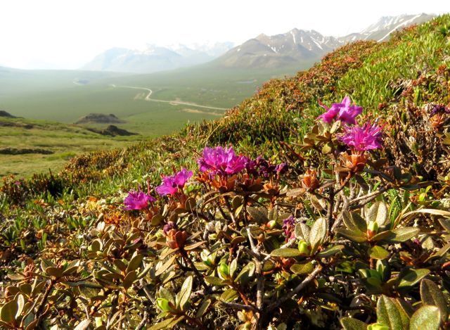 Down below is the dusty Dempster Highway (the only part of my trip that was unpaved – except for side roads and the lengthy areas of construction.)
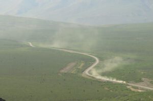 I was due to give my talk that night so began to wander down the mountain, well pleased with my day, but the surprises hadn’t finished yet. Suddenly, I was attacked.
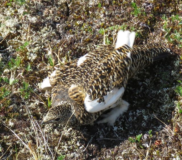 This picture cannot convey the startling animosity of this bird. Obviously a ptarmigan, it was just as obviously not the willow or white-tailed ptarmigan, which I have at home, but must be the rock ptarmigan. Uttering deep guttural croaks it kept thrusting its shoulders forward and rushing at me. Other ptarmigan, and grouse, detract predators from their young by running away and dragging their wings as if they are broken, enticing the carnivore away. But this display was very different. Sure enough, soon the herbage was full of peeping fluffballs and I left her and her family alone.
The day had been hot and sunny but cool enough high up to be pleasant. However, about an hour before my talk was due, a furious thunderstorm broke overhead. It was raining so hard I didn’t want to get out of the middle part of the van and run around to the driver’s side to close the door. The lightning struck nearby with horrendous bangs again and again. Soon the rain turned to hail. It eased off just in time for me to move to the slide show shack, but first I had to scoop about 4 cms ice balls off the shelf inside the driver’s window. The seat, needless to say, was wet! The temperature had dropped considerably and I now shivered in heavy sweaters and longjohns.
I showed slides of my own mountain flowers, comparing them with local ones. The audience was largely composed of Friends of the Dempster, in other words locals (maybe from Whitehorse) rather than other tourists. They were all very interesting people – not at all young, but completely at home with camping and nature and unfazed by the inclement weather. I felt right at home. I can see why people love to live in the Yukon. For my efforts I had free camping for four nights, and also received an honorarium, which was not expected.
I went on a river walk in the morning with a visiting botanist. Very interesting group. The walk ended at the aufeis, where American tree sparrows were warbling in the willows.  Aufeis is a phenomenon common in the north where something (perhaps freezing) causes a blockage of the river and slush ice and water pile up over it. Long after the snow has melted and the lakes have gone out, the aufeis remains. Here it is seen from a high point in the road the day before.
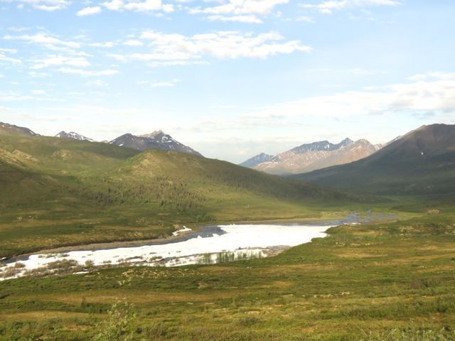 And at the end of our walk.
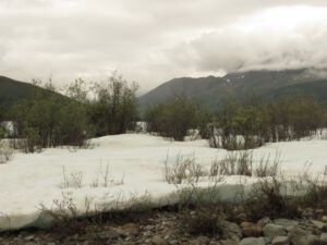 That afternoon, new friends took me north of the park to a boggy area. The edge of the road was home to Phacelia mollis, an apparently rare species of scorpion weed, although here it seemed to be colonizing happily.
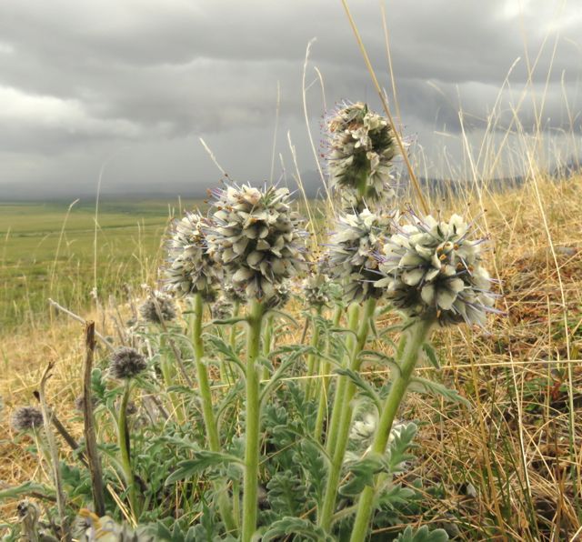 We had barely got out of the cars, however, before another furious thunderstorm drove us back inside. As it eased, we ventured out once more onto boggy tundra. (This cotton grass is supposed to be fluffy. It is definitely having a bad hair day.)
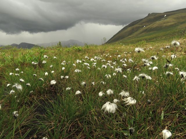 and found a few plants of interest, such as bistort,
 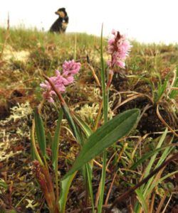 but all were pounded by the rain and hail. I was delighted to see my first wild poppies since the arctic. It was difficult to find a relatively undamaged specimen.
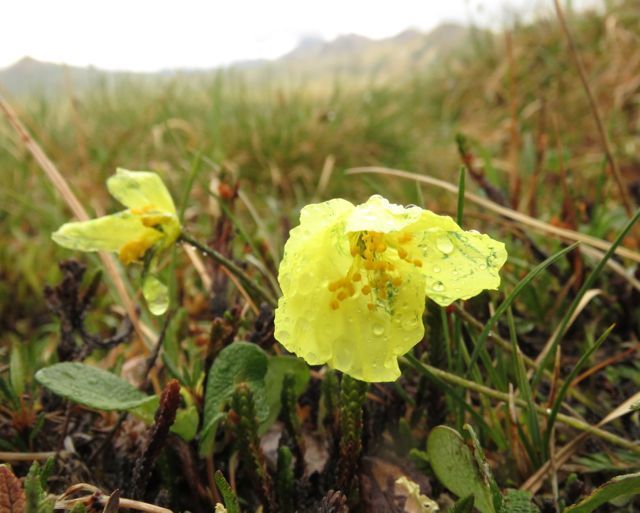 The following morning was my last in the Tombstone area. I drove to a communications towner and had a drizzly walk that would have had great views on a good day. On the whole the flora was not very interesting – with the exception of a single plant of another new species for me, Lessings arnica. It’s drooping is normal and not just a result of the rain. It was an exciting find with which to end my trip.
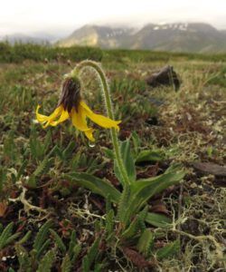 After this, there was only one direction to go. I began the long journey south.
This is the sixth of 8 Yukon Journey posts. I screwed up when loading them. To access #7, press the left-had arrow saying “previous.”