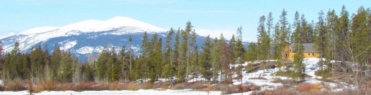
This is fire post #8, and builds up to a flare-up.
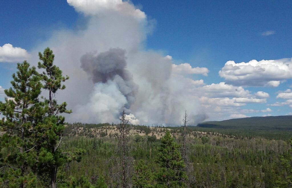
The above picture was taken August 4 from west of the highway near the Terra Nostra Guest Ranch. If you look closely in the middle of the picture to the right of the fire, you can see the tiny dot of a plane. My place is more or less below that, about 1/2 km behind the dunes. This is not a big flare-up in the scheme of things, but pretty scary when it is so close and out of control.
This is a confusing post of scraps of information that don’t always make sense, but this is how fires stumble along.
On 27 July, the BC Wildfire Service site announced for the Big Stick Fire:
Status: Active
Fire guard has now been placed all around the perimeter of the fire by heavy equipment. The fire took some precipitation that reduced fire behaviour until temperatures warmed in the afternoon.
Firefighters conducted mop up operations on the northeastern and southeast [southeast is my area] flanks where planned ignitions occurred. Firefighters conducted a planned ignition on the southwestern corner of the fire to further secure the fire guard lines already in place and will work to mop up those areas today.
Due to successful planned ignitions almost all fuels have been removed up to the fire guard except for a small portion of the southeastern and southwestern flanks. Today, the focus will be on continuing to mop up priority areas on the north flank by utilizing direct attack tactics with support of helicopter bucketing operations.
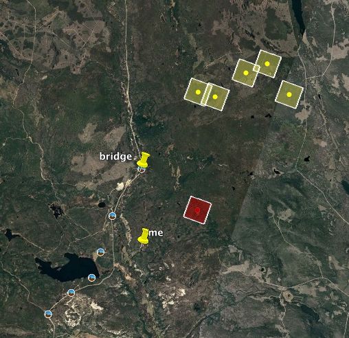
The red squares started on the Google Earth Fire Mapping Program on 31st July. BC Wildfire Service Service commented:
On the east of Highway 20, hand ignition [ground back burning] was used to burn fuels between the containment lines and the fire. Crews were patrolling the ground and activating helicopters to cool the area down. Early the following morning, Google Earth registered this.
In the mean time, the Hotnarko fire was showing alarming red areas, as was the small, high, out-of-control Talchako fire south of my friends’ place. We had seen an ominous cloud of smoke a couple of evenings before, not sure if it was this fire or a new one, but it was in fact the Talchako fire. It is in a very tricky position to fight, but seems not to be spreading too much, and apart from occasional low-lying smoke that fills the valley, remains on the sidelines.
I looked for information on the Hotnarko fire, but received this, which was posted on July 28 and has not been updated.
Hotnarko Creek (C51355)
This is the final update for the ‘Hotnarko Creek’ fire; no further updates will be posted on this website as it is no longer considered to be a Wildfire of Note. If you require updated information on this fire, please contact the Cariboo fire centre.
Last updated: Wednesday, July 28, 2021 at 10:55 AM
Location: Hotnarko Creek
• See approximate location of this wildfire on an interactive map
• View an interactive map of all active Wildfires of Note. (This fire has been archived so it will no longer be displayed on the interactive map.)
Discovered: Saturday, July 3, 2021
Size: 1,500.0 hectares (estimated)
Status: Active
**As of July 28 at 21:00, this fire will no longer be considered a Wildfire of Note.**
The fire is now classified as Being Held.
Firefighters have completed a 100-foot blackline along the north and east flank.
There was a scan completed on the fire Monday night. Today, efforts will be focused on patrolling and extinguishing hot spots from the scan. Sprinklers have been set up on the interior areas of the fire to help cool the fire throughout the night.
A friend sent me this, however. I Could not find it on the BCWFS site but think it’s from Facebook August 1. (which I don’t do.).
On August 2nd, this was on the site for “my” fire.
Big Stick Lake (C51290)
Last updated: Sunday, August 1, 2021 at 10:15 AM. [ It may have been updated then, but did not appear on the site until many hours later.]
Location: North of Big Stick Lake
• See approximate location of this wildfire on an interactive map
• View an interactive map of all active Wildfires of Note.
Discovered: Friday, July 2, 2021
Size: 7,020.0 hectares (estimated)
Status: Active
Warmer conditions in combination with elevated winds resulted in increased wildfire behavior. There was a small excursion across the guard on the north flank on the east side of Highway 20. Helicopters bucketed water onto the fire to help cool the hot spot. Today, heavy equipment will focus their efforts on securing hot spots by creating a fuel free guard around them. Ground personnel will patrol and extinguish hot spots and continue patrolling the perimeter of the fire to secure the line.
As long as the fire stayed in the north part, all would be OK for me. Nobody lives on the north east side. I planned on making a trip home on Aug 5, and figured it would probably be safe to stay. On Aug 3 I started planning what I would take – I would leave some stuff down here just in case. I also spent several hours down-valley at a You-pick organic blueberry patch.
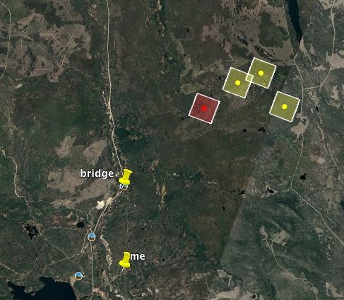
That afternoon, on Google Earth…
Oh no!!!
There was an email the following morning upgrading our Alert Status to Evacuation Order – extending half way to Tatla Lake. There is a blue shape like the letter J in the middle of the picture. My property is the closest square to it.
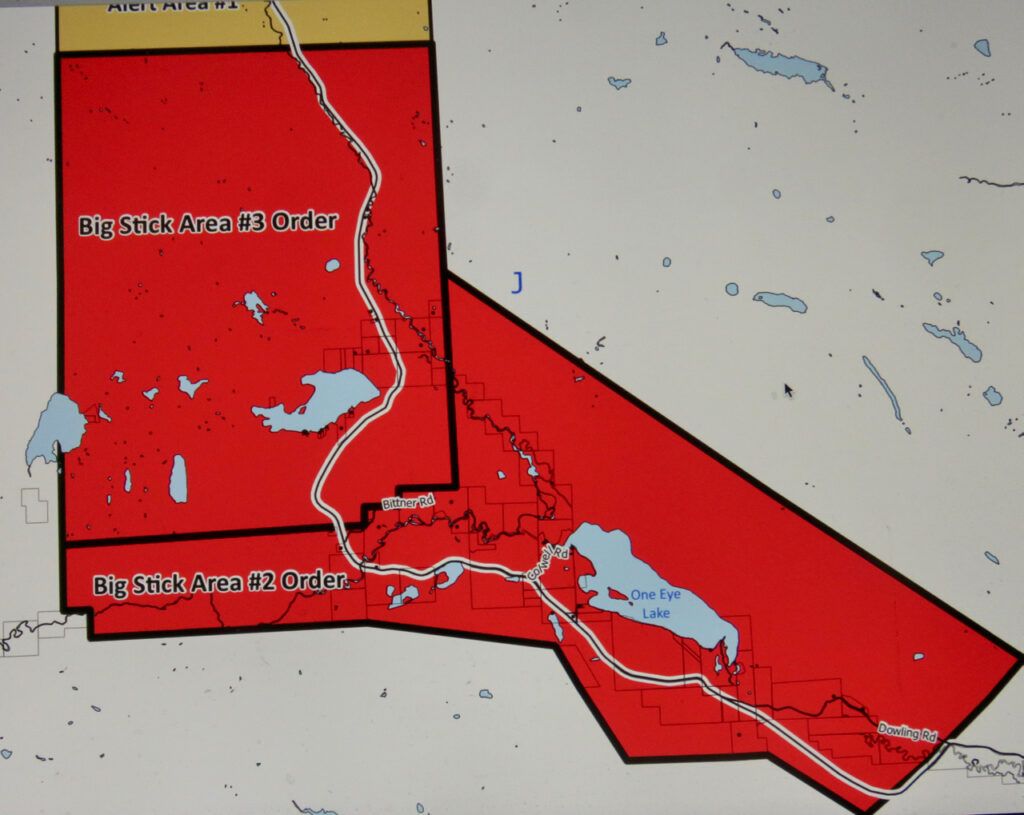
This looked horrifying, but on second thoughts it seemed a bit extreme for one red square on Google Earth, particularly as the dominant winds are south to west. Although I noted the order on August 4, it had been issued late the evening before and cops went around to tell everyone – at Terra Nostra Guest Ranch they were woken up at 1.30:AM to be given the news. I would be very surprised if anyone else actually left as they all had safe accesses to the highway.
As usual, the BCWFS info was dated and skimpy at best.
Status: Active
The fire did receive some precipitation on Sunday [Aug 1] and resulted in increased relative humidity. This decreased fire behavior until the afternoon when there were warmer temperatures and wind. On the southwestern flank, firefighters are continuing to patrol and extinguish hot spots.
Skimmers worked to cool the excursion [this was a “small excursion” of the fire to the north] from Sunday while firefighters and heavy equipment continued to establish a tightline a fuel free guard. [their confusing grammar]
A scan was completed last night (August 2), and crews will prioritize hotspots found and action accordingly.
[finally we get to the point.:
Update: Sustained winds have increased wildfire behaviour on the southern flank of the wildfire.
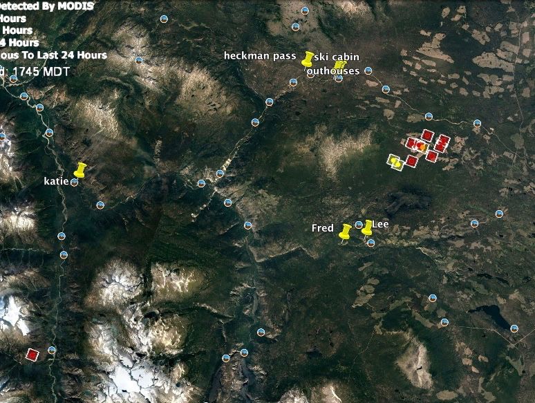
By the afternoon of Aug 4, Google Earth looked like this.
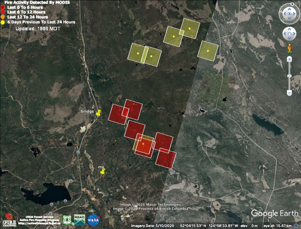
Which is pretty much when the picture at the beginning of the post was taken.
Still a couple of kilometres away, but very strong winds are forecast for today and tomorrow. Moderate winds Saturday and calm Sunday – when the wind will switch to the north.
The good news is that the temperature is supposed to drop from the 30Cs to 22C. Precipitation is also forecast – there may be showers. But there also may be thunderstorms.
The info on the BCWFS site is currently this:
Status: Active
The fire is experience low fire behaviour this morning and received a small amount of rain on site. There has been poor visibility due to smoke, which is impeding air operations. Crews are working along the south flank, patrolling and actioning hotspots where the excursion happened a few days ago.
Firefighters will work to secure line and extinguish hot spots to help contain the wildfire.
It is supposed to be cool and damp over the weekend so fingers crossed the fire will stay manageable. I’m now looking at the possibility of going home on Sunday (I’ve run out of vegetables!!) but won’t stay as the following week the temperature will climb into the 30s again.
In 2017, the last big even was August 18. When the fire first started July 2nd I knew this was going to be a long haul. But now there are just 2 weeks to go before that magic date, and maybe – just maybe – I will have a home to go back to.
We earnestly hope, you could spend your birthday at home, wish you all the best, stay safe and healthy
Brigitte and Rolf
Thanks for the update! Keep safe and hang in there! We have a cabin on Clearwater Lake, the south side, and appreciate the updates. Here is hoping that your property is spared.