
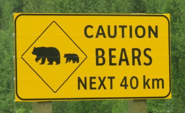
 This sign is a joke. There were dozens of bears for the next 400 kms. I soon didn’t even bother to stop for them.
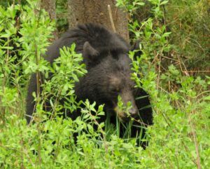
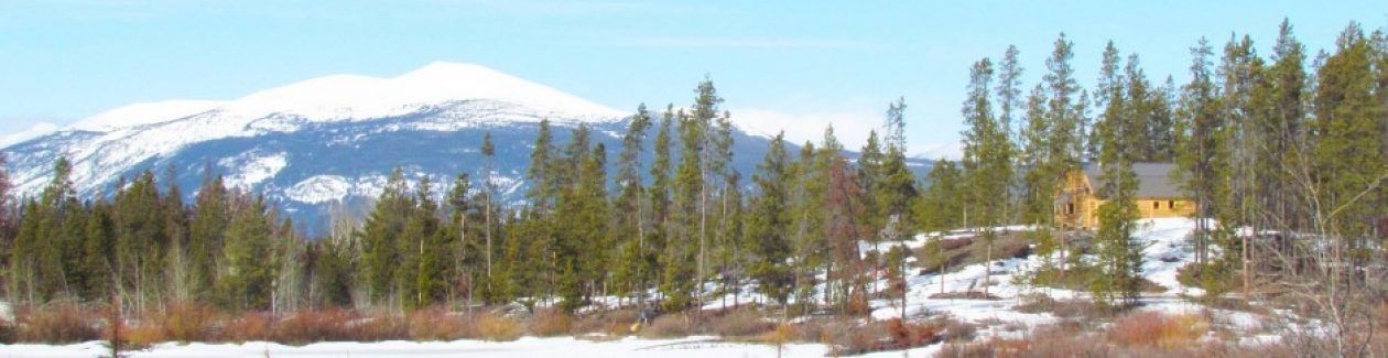
The next section of my journey took me from an abandoned gravel pit just north of Meziadin Junction to Whitehorse, and lasted three days.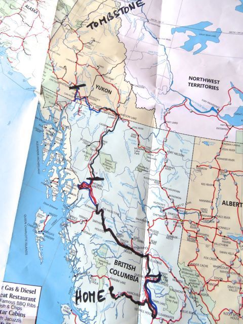 The Cassiar Highway parallels the Coast Range and at first there are lots of views of the mountains.
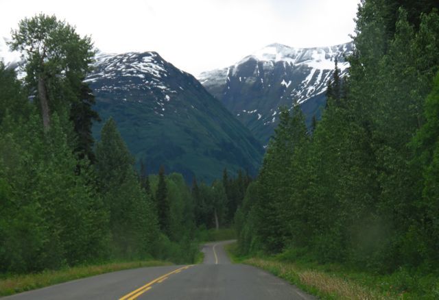 These diminished in size somewhat and the roadsides became more scarred by industry. It was paved all the way but the centre line disappeared and the surface became rougher – much like driving along Highway 20 to Bella Coola. As the scenery grew less interesting, however, the roadside flowers increased. Lupins were common.
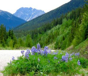 Then a number of other different pea relatives – here is common yellow locoweed and wild roses.
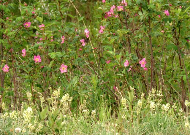 And, most spectacular of all, the Hedysarum mackenzii (mixed with the common yellow locoweed.) This was a plant that would grace the roadsides for many hundreds of kilometres.
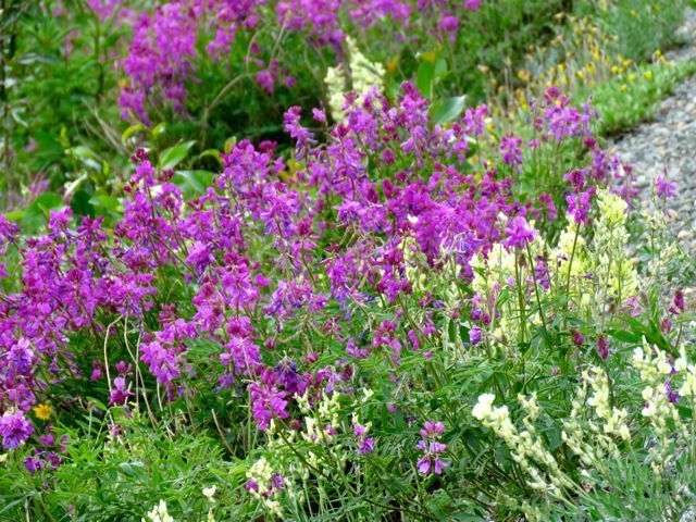 One time I saw a movement in a ditch. I drove back to investigate. It was a fox.
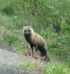 All the ones I saw seemed to be this sort of sandy grey mix of colours.
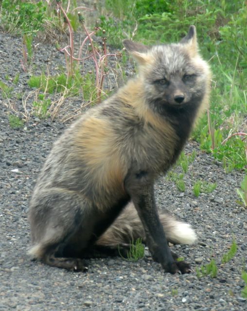 The Cassiar Highway exits BC just 20 km west of Watson Lake, where it joins the famed Alaska Highway. Constructed by the Americans in World War 2, it runs from Dawson Creek in south BC, and enters Alaska west of Dawson City, and finally ends up in Fairbanks. The Alaska Highway is a far different kettle of fish than the Cassiar. Wide and fast except on it’s northern stretches, it is choked in the summer with vacation vehicles, many of them, in my opinion, obscene.
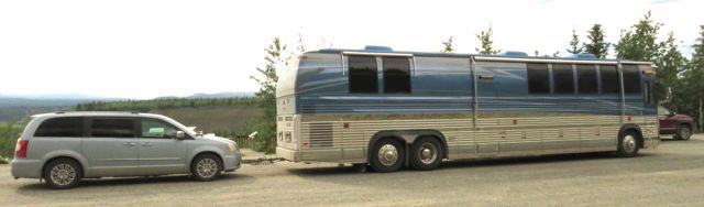 Yes, this is actually a motor home. Towing a limousine behind it. Not only did these vehicles take up multiple parking spaces, they also kept their motors running while at “rest” stops, adding to the racket of the highway. And where would they be able to stay? Only at select places where other mega motor homes could be crowded together. No doubt they were air-conditioned. Because of the persistent rain on my trip, I was uncomfortable often in my little van – but I cannot imagine anything less connected to the environment than travelling in one of these behemoths – except perhaps being in a coach on a guided tour. Licence plates were from all over the world but primarily from every corner of the States. Their owners had one thing in mind. Drive the Alaska Highway. The fact that they had to go through Canada to do it was incidental.
I spent the night not far west of Watson Lake in a brushy pull-off near a river – and heard a generator all night. Morning showed an industrial camp across the water. There was also a creature snuffling around the van – might have been a bear or a porcupine. The nights, although much shorter now and never completely dark, were still dark enough to need a flashlight, but I couldn’t see anything when I turned it on.
Everyone who had been up north advised me to fill my tank when it is half empty. I was amazed how cheap the gas was – nowhere except once, did I pay as much as it costs on the Chilcotin! Most places named on the map are little more than a gas station-cum-motel-cum convenience store. They are very utilitarian places – aesthetics is usually ignored. Some have First Nations Reserves around them. Speed limits are in place – and in Teslin they are reinforced by a cop car.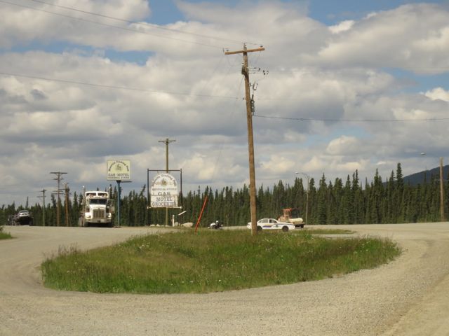 Until you drive closer and see that the cop car is a painted plywood cut-out! Very effective, though.
I took a detour along the road towards Skagway.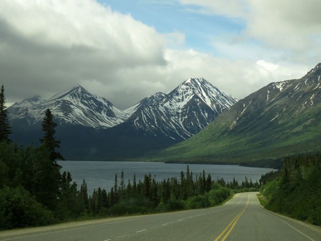 There were more lupins by the road,
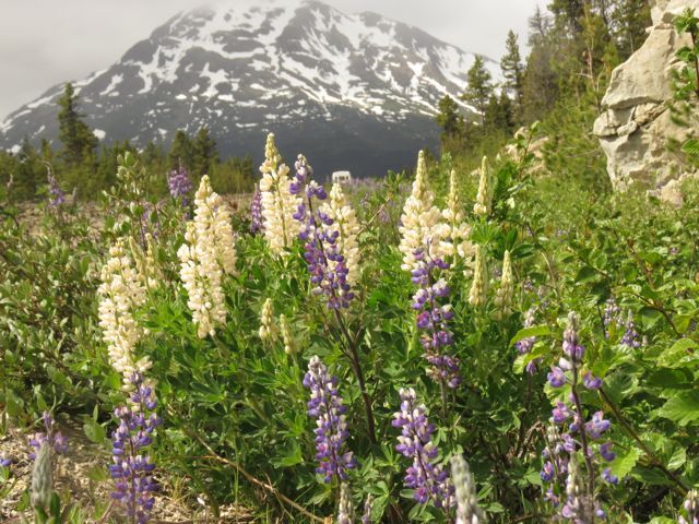 and red columbines,
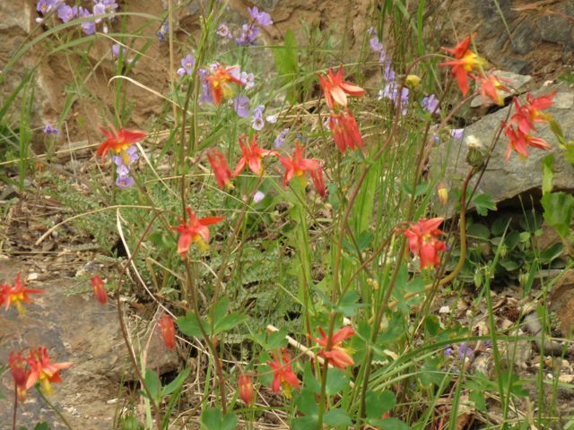 and lots of Jacob’s ladder.
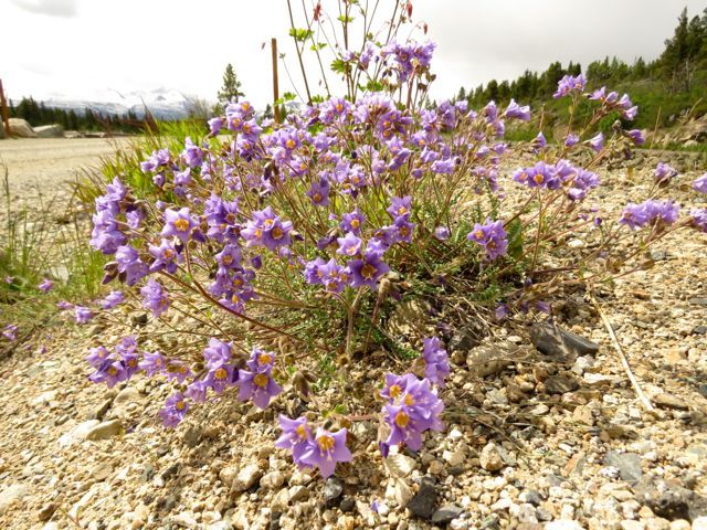 But most noticeable were the dozens upon dozens of tourist buses all on a day trip from the U.S.
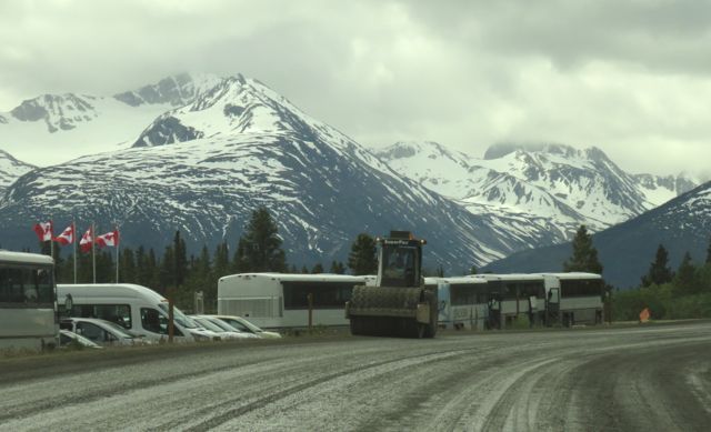 I was also astounded at the number of motorbikes I encountered. Even when the roads were surfaced with gravel. Literally thousands of them.
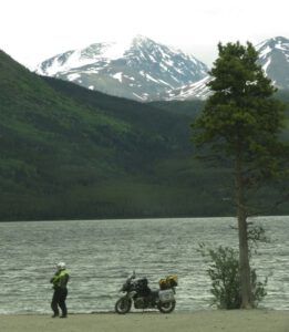 At one point I saw a bear. A nice ginger-coloured black bear.
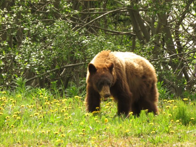 He was quietly feeding as I watched – next thing a string of tourists screeched to a halt and the poor animal fled.
I wasn’t going to attempt crossing the customs post here.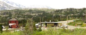 The topography, however, was quite interesting, with a flat area of glacier-worn rock in the middle of the valley.
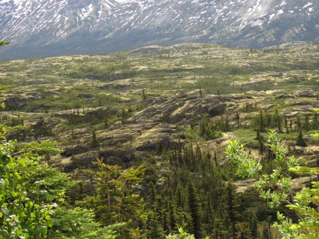 Not much except lichens appeared to be growing on it although the roadside cliffs were dotted with clumps of prickly saxifrage.
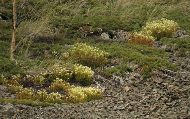 At first glance this would appear to be the same plant that is common on similar habitats in the mountains of home, but Saxifraga tricuspidata is in fact a different species. It has three teeth at the ends of the leaves and no spots on the petals. I last saw it blooming in the arctic 25 years ago!
And so east to Carcross. All the north abounds with culture and mining history but if I’d stopped for every one of the places of interest I would have needed twice as long to complete my trip. I decided to focus on the flowers. Friends used to live near Whitehorse on a road that ran high above the town to a place called Fish Lake. It turned out to be a place well worth visiting.
The weather had deteriorated so I crawled into my van in a nearby quarry after photographing nagoon berry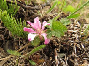 And the first of thousands of pictures I would take of the Bluebells or Languid Ladies that are so common in the north – but do not grow in my area.
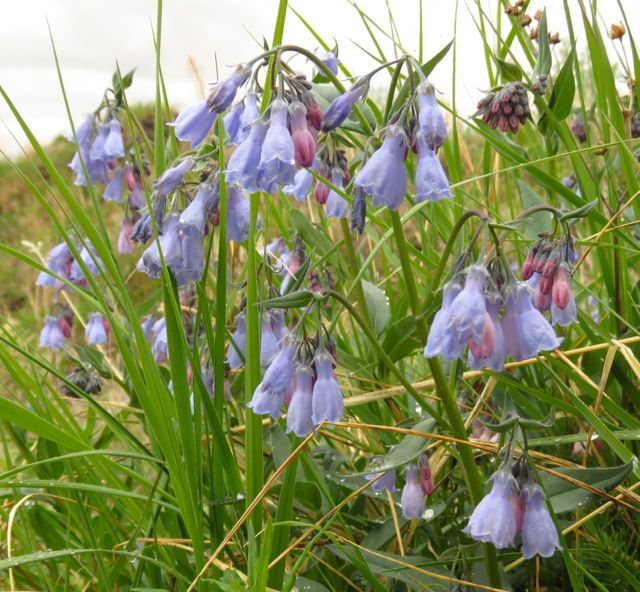 During the night the sky cleared and I had to scrape encrusted ice off the windshield. My morning bath in a basin, al fresco, was decidedly nippy. I was back down in Whitehorse by 8.00:am as I wanted to see a mechanic. The day before, the van had started to smell of hot rubber or tar. A bit like hot brakes, but the hubs were cool and all the gauges on the dash were normal. Nothing seemed to be spattering in the motor, and when it was parked on tarmac, nothing seemed to be dripping. However, the smell started a few minutes after I began driving and was quite nauseating. As I came north of Carcross, it got worse.
Naturally, no mechanic could see me that day, but I got an appointment for 8.00:am the following morning. So instead of driving on, I first visited the Beringia museum to learn about local mammoths, then returned to my quarry campground. At first I was content to sit in the sun and enjoy the pleasure of not driving. Then I followed a logging(?) road a little way – and found a trail up through the forest onto a ridge. Below was Fish Lake. (Note, once again, the threatening storms.)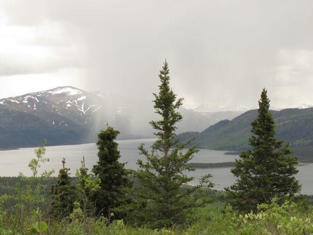 At the top of the ridge I found rock outcrops that had a lovely selection of flowers. The Yukon territorial flower, the forget-me-not.
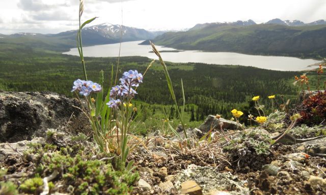 The tiny lignonberry – a first sighting for me although it is abundant everywhere in the north.
 And a real treat for me, yet another pea, the blackish oxytrope.
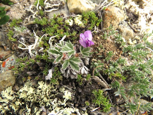 Apart from a few spits of rain, I didn’t get wet – until I returned to my van. I just had time to grab laundry off the bushes before the heavens opened and once again I dived under my bug net and whiled the twilight hours away.
As I drove back down to Whitehorse again, I noticed that the rubbery smell wasn’t as bad. The mechanic checked everything – and could find nothing wrong. All we could conclude was that, on my way to Skagway, I had driven over some road works and must have picked up a gob of oil or tar that lodged onto the motor or tailpipe, and which eventually burned away. The van is approaching its 300,000km birthday so I felt the babying was necessary – and was glad it happened close to Whitehorse. I never had any trouble with the vehicle on the trip again.
This is the second of 8 Yukon Journey posts. I screwed up when loading them. To access #3, press the left-had arrow saying “previous.”